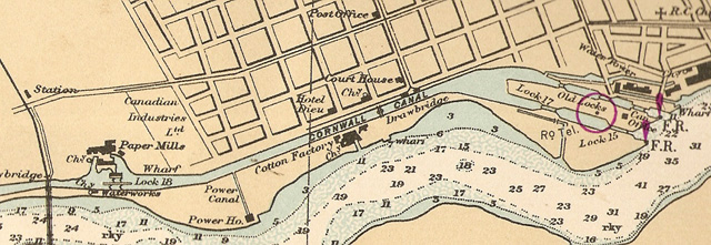
Map of the Cornwall Canada and River.
This map of the canal area and the St. Lawrence River shows where the dry docks were located (just above the words “Old Locks”). You can also see the location of the day markers. RED balloons on this chart near the right-hand side. There are two red balloons marked “FR” (front range marker) and one red circle about the mid-canal lock, “RR” (rear range marker). A ship’s captain would line up the red circle, which was actually an inverted triangular board, with each of the FR markers in turn (which were an upright triangle marker) and that would indicate where he should aim the ship to enter the canal. Later they had lights on the markers. Markers are still used in navigation on some parts of the river.
~ Ray Amell Collection
